What to Expect From a Professional Aerial Surveying Service
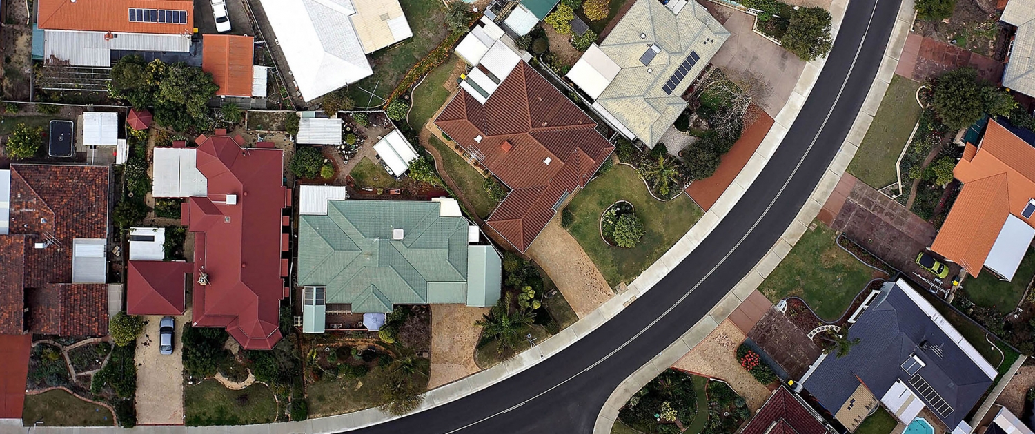
When timelines are tight and accuracy matters, aerial surveying has become a practical tool for organisations that need reliable spatial data without unnecessary disruption on site. From construction firms and local councils to strata managers and agricultural operators, drone-based surveys support informed decision-making early in a project lifecycle.
Understanding what a professional service includes helps set realistic expectations and ensures the data you receive is fit for purpose. Let’s break it down.
A Clear Scoping Process From the Start
A professional aerial surveying provider begins by understanding the outcomes you need, not just the area to be flown. Site size, terrain complexity, accuracy requirements and how the data will be used all shape the survey approach.
For instance, a construction company may require CAD-ready base plans for design, while a vineyard may prioritise terrain modelling or volumetric data for earthworks planning.
Collaborating with experts from the beginning avoids generic deliverables and ensures the survey is designed around your workflow. At Perth Drone Centre, surveys are tailored to each project, drawing on decades of experience in technical drafting and spatial documentation through Perth Cadcentre.
Compliance, Safety and Certified Pilots
Drone operations in Australia are regulated, and aerial surveying is no exception. A professional service operates under CASA certification and uses licensed pilots who understand both aviation safety and data capture standards. This matters on active construction sites, near infrastructure, or when working for councils and commercial asset owners who require full compliance documentation.
Pre-flight planning includes:
- airspace checks
- site risk assessments
- automated waypoint programming
Our structured approach reduces risk, ensures repeatable results and limits disruption to normal site activity.
High-Accuracy Data Capture Using Industry-Grade Equipment
Modern aerial surveying and mapping rely on more than a drone and a camera. Professional operators use RTK-enabled drones, high-resolution sensors and ground control points (GCPs) to achieve centimetre-level accuracy. Flights are planned to maintain consistent overlap and altitude, supporting precise photogrammetry outputs.
This level of accuracy allows drone surveys to support tasks traditionally handled by ground-based methods, often with faster turnaround times. Large or difficult-to-access sites, such as shopping centres, industrial facilities or rural landholdings, can be captured efficiently without extended field crews.
Processing That Turns Imagery Into Usable Outputs
Raw imagery is only one part of aerial surveying. The value lies in how that data is processed and delivered. A professional service converts captured images into structured datasets using specialist software, ensuring outputs are geo-referenced and aligned with Australian coordinate systems. Common deliverables include orthomosaic maps, 3D point cloud models, digital terrain and surface models, contour data and topographic plans.
These outputs integrate directly into CAD, GIS and civil design platforms, allowing engineers, planners and asset managers to work with the data immediately. Perth Drone Centre also provides aerial survey to CAD conversion, bridging the gap between site capture and design documentation.
Applications Across Multiple Industries
Aerial surveying supports a wide range of commercial and public-sector applications. Construction companies use drone surveys for site planning, progress tracking and “as constructed” verification. Local councils rely on aerial data for asset management, land assessments and infrastructure planning. Agricultural businesses benefit from terrain modelling, drainage planning and stockpile volume calculations without disturbing crops or operations.
Stockpile measurement is a strong example of where aerial surveys add immediate value. Drone-based volume calculations provide accurate reports without ground crews, supporting safer operations across mining, construction and material handling sites.
Faster Turnaround With Minimal Site Disruption
One of the key advantages of professional aerial surveying is efficiency. Drone deployment requires less time on site compared to traditional methods, particularly across large or complex areas. This reduces downtime, limits access restrictions and allows surveys to be completed around normal operations.
Despite the speed, accuracy is not compromised. Automated flight paths and consistent data capture support repeat surveys over time, which is valuable for monitoring change, progress or asset condition.
Ready to Get Accurate Aerial Data for Your Next Project?
Experience in spatial data and technical documentation makes a measurable difference. Perth Drone Centre is built on more than 35 years of CAD, surveying support and site documentation expertise.
When done properly, aerial surveying and mapping support better planning, safer sites and more confident decision-making across a wide range of industries.
If you are considering aerial surveying for an upcoming project, get in touch with us to discuss a solution tailored to your site and objectives.


